
Georgia Hikes: Amicalola Falls Trail
The varied hiking trails coupled with incredible scenery make Amicalola Falls State Park one of Georgia’s most popular state parks. Hike to the top of the state’s tallest waterfall and take in beautiful Appalachian views.
Hike from the bottom of Amicalola Falls to the top overlook for an incredible view of Georgia’s tallest waterfall.
Amicalola Falls Overlook Hike
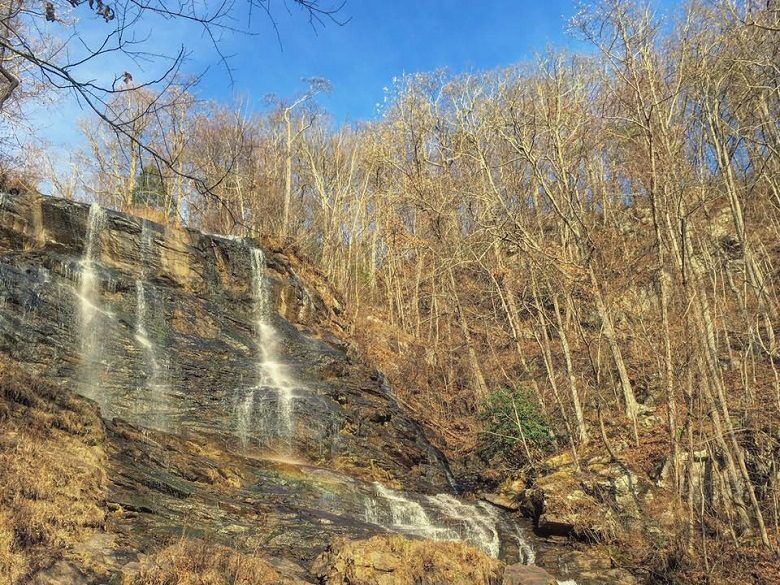
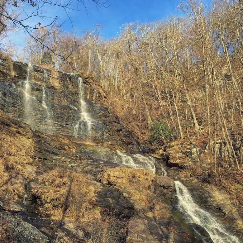
The cascading Amicalola Falls is the main attraction of the Amicalola Falls State Park, so while the waterfall overlooks will be crowded, your hike may not be. We started our hike at the bottom of the waterfall and made our way up to the top overlook.
East Ridge Trail

The hike begins behind the Visitor’s Center on the East Ridge Trail. Follow the marker for “Maine to Georgia;” the East Ridge Trail was previously used as the old approach to the Appalachian Trail.
The trail climbs quickly through a series of switchbacks and passes spots perfect for hanging a hammock and resting. The trail reaches 400 feet and meets a gravel road at 0.6 miles. This is an old roadbed that used to go from the Visitor’s Center to the waterfall overlook.
With the gravel trail wide and open, you’ll be able to take in the spectacular views of the mountains the valley below off the left side of the trail.

You can start to hear the falls as you approach the paved parking lot at 1 mile. Follow signs for the overlook. The trail will cross a wooden bridge, the Upper Observation Platform, spanning the top of the waterfall and looking out over the Southern Appalachians.
West Ridge Staircase
Continue your hike down the stairs, following the West Ridge Staircase to the Appalachian Approach Trail at the base of Amicalola Falls.
This staircase will take you down 425 steps to the Lower Observation Platform, which spans the falls a third of the way down. You’ll get a closer view of the tumbling waters here, and this is the perfect spot for a waterfall selfie.
Appalachian Approach Trail

The trail continues down 175 steps on the Appalachian Approach Trail to another platform at the very base of the falls, offering a view of Amicalola Falls in its full glory.
Here, the trail levels off and follows a paved path along the resulting creek and passing the Reflection Pool at 1.5 miles and crossing to the other side of the creek.
Finally, the trail crosses the road and winds around picnic areas, playgrounds, and the Lower Amphitheater before looping back to the trailhead at about 2.1 miles.
Hiking Essentials
Come prepared for your hike by making sure you pack the essentials. Check out this must-have hiking gear before you set off on the trails:
Amicalola Falls Trail FAQ
Can you drive to the top of Amicalola Falls?
You can drive to the top of Amicalola Falls and take a short walk from the parking lot at the top to the bridge overlooking the waterfall.
Can you see Amicalola Falls without hiking?
You can see Amicalola Falls without hiking, but there is still a short walk from the parking lot at the top of the falls.
How far is Amicalola Falls from Atlanta?
Amicalola Falls is about 77 miles from Atlanta, or a 1.5 hour drive.
When is the best time to visit Amicalola Falls?
The best time to visit Amicalola Falls is in the fall when the trees are changing color. Visit during September-November, but be ware that there may be more crowds at this time of year as well.
Nearby Hiking Trails
Discover these other great hiking trails near Amicalola Falls State Park.
Ready to visit Dawsonville, Georgia? Plan your trip with these tips.
- Book Your Flight: Find the cheapest flights using Skyscanner, my favorite flight search engine.
- Find Accommodation: You can find top cabin rentals in Dawsonville on VRBO.
- Start Packing: Check out my packing list resources so you’re prepared for your trip.
Cheers!
Paige

Have you hiked to the Amicalola Falls Overlook at Amicalola Falls State Park? Let me know about your adventure in the comment section below!


