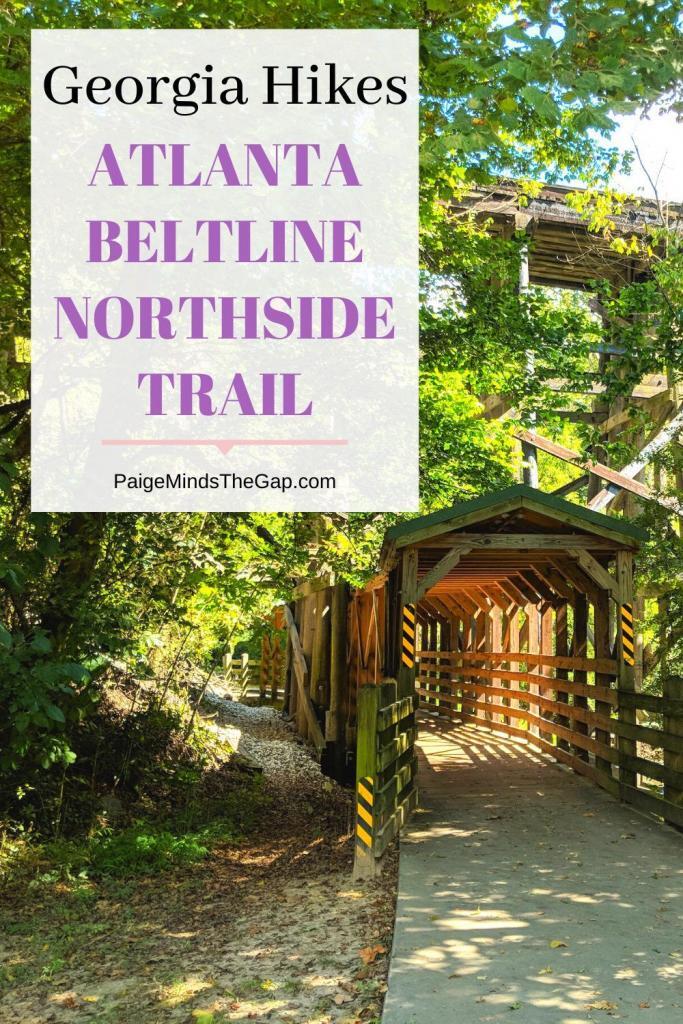
Atlanta Beltline Northside Trail: Ultimate Guide
The Atlanta Beltline Northside Trail is a peaceful, tree-lined walk that’s a hidden gem in Buckhead.
The Northside Trail is a 1-mile pathway that winds through Tanyard Creek Park and along the Bobby Jones Golf Course in Buckhead that feels miles away from the high-rises and skyscrapers.
This is the most scenic part of the Beltline trail so far. Here’s everything you need to know about enjoying the Atlanta Beltline Northside Trail.
What is the Atlanta Beltline?
The Atlanta Beltline is a former railway corridor around the city that is undergoing redevelopment. Plans include a streetcar loop, 2,000 acres of parks, and 22 miles of multi-use trails.
Segments here and there have already been developed, but the whole loop hasn’t been completed yet. You can read my guide to the popular Atlanta Beltline Eastside Trail here.
Atlanta Beltline Northside Trail
The Atlanta Beltline Northside Trail was the first of the Beltline trails to open. It’s located on the north side of Atlanta in Buckhead.
The trail runs from Woodward Way (Atlanta Memorial Park) in the north to Goodson Lane (Ardmore Park) in the south.
You can access the trail from Atlanta Memorial Park where there is a parking lot off Woodward Way and Havenridge Drive; through Tanyard Creek Park just off of Collier Road where there is a small parking lot across from Overbrook Drive; from the Bitsy Grant Tennis Center where there is a parking lot and a connector trail to the Beltline; and from Ardmore Park where there is street parking along Ardmore Road.
If you start your hike from Tanyard Creek Park or the Bitsy Grant Tennis Center, you’ll be starting from the middle of the trail.
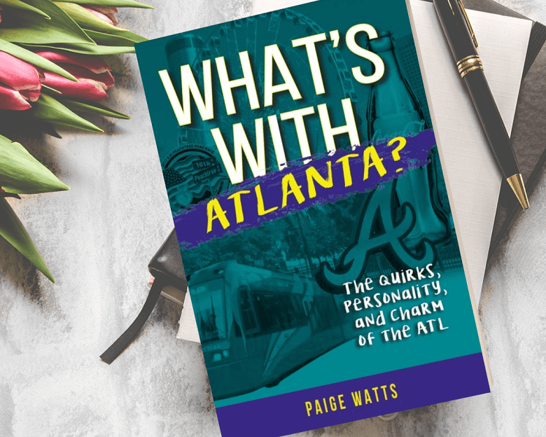
Want to learn all about Atlanta? Check out my new book, What’s With Atlanta?: The Quirks, Personality, and Charm of the ATL. Whether you’re a local or are just passing through, this entertaining guide will answer all of your Atlanta questions.
Trail Details
I recommend starting from the north and following the trail south because the parking lot at Havenridge Drive is larger and less busy than the parking lot at Tanyard Creek Park. But a lot of people do start from Tanyard Creek Park.
The Atlanta Beltline Northside Trail runs through Atlanta Memorial Park, following along Peachtree Creek on the outskirts of the Bobby Jones Golf Course.

It’s not long before the trail turns and crosses over Peachtree Creek, following along the side of Colonial Homes Circle and the golf course where it combines with the Tanyard Creek Trail.
The trail curves to the west and starts to become more tree-covered. Soon, the trail diverts away from the golf course. Here, you’ll find the off-shoot connector trail that leads to the Bitsy Grant Tennis Center, named after Atlanta tennis legend Bryan M. Grant Jr.
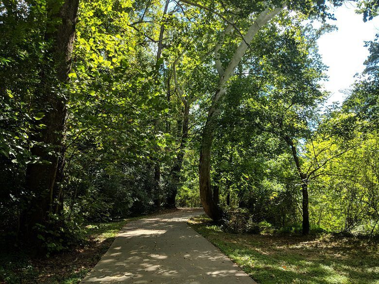
The Northside Trail becomes fully immersed in the trees, showing just how Atlanta got it’s nickname of “the City in a Forest”.
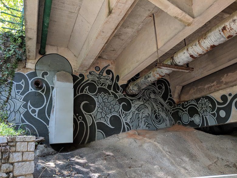
The trail crosses a bridge over Tanyard Creek, winds through the trees, continues past the Louise G. Howard Park on the right with its pavilion and little lending library, then uses an underpass lined with street art to cross under Collier Road.
Here, the trail has reached Tanyard Creek Park. The trail then passes a playground and crosses over Tanyard Creek again over a wide bridge and makes its way through the park, following alongside the path of the creek.
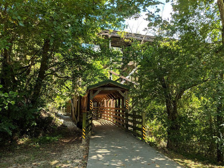
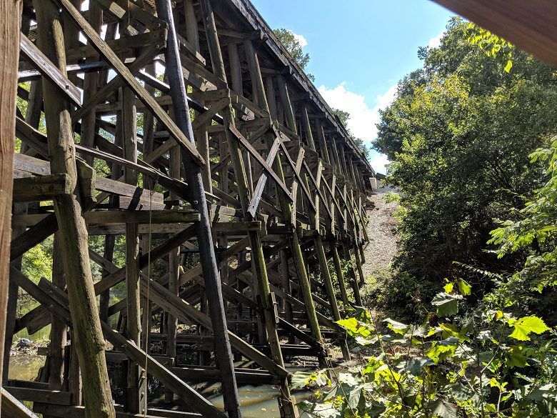
It makes it’s third pass over Tanyard Creek and the comes to a beautiful covered bridge beneath a 30-foot tall wooden railway.
Past the covered bridge, the trail enters Ardmore Park. Taking the fork to the left takes you to the Ardmore Park Playground with some fancy play equipment that will send you spinning and make you extremely dizzy, if you’re interested in that sort of thing.
On the fork to the right, you can continue through Ardmore Park under a canopy of trees. The ends abruptly here at a townhome complex at Goodson Lane.
The walk from Woodward Way to Goodson Lane is about 1 mile. Turn around and retrace your steps for a full hike of 2 miles.
Atlanta Beltline Northside Trail Visitor Tips
The trail is free to access.
You can find free parking on the streets in the surrounding neighborhoods near Ardmore Park (like along Ardmore Road), around Atlanta Memorial Park (like at the Bitsy Grant Tennis Center and at the 2276 Havenridge Dr parking lot), and at Tanyard Creek Park off of Collier Road.
View a trail map here.

Planning your first trip to Atlanta?
Get your FREE Welcome To Atlanta Kit, complete with a budget guide, hidden gems, travel planners, and more!
Hiking Essentials
Come prepared for your hike by making sure you pack the essentials. Check out this must-have hiking gear before you set off on the trails:
Things to See on the Atlanta Beltline Northside Trail
Here are the major sites and things to see along the Atlanta Beltline Northside Trail that are totally worth the detour:
- Atlanta Memorial Park
- Bobby Jones Golf Course
- Bitsy Grant Tennis Center
- Boone’s Restaurant
- Louise G. Howard Park
- Tanyard Creek Park
- Ardmore Park
- Ardmore Park Playground
Atlanta Beltline Northside Trail Info
Hike length: 2 miles round-trip
Difficulty: Easy
Is it pet-friendly?: Yes, leashed dogs are allowed on this trail.
Location: 289-301 S Colonial Homes Cir NW, Atlanta, GA 30309
Parking: Free street parking is available in the surrounding neighborhoods near Ardmore Park (like along Ardmore Road), around Atlanta Memorial Park (like at the Bitsy Grant Tennis Center and at the 2276 Havenridge Dr parking lot), and at Tanyard Creek Park off of Collier Road.
Fees: Free.
Hours: The trail is open 24 hours.
Accessibility: The Atlanta Beltline Northside Trail is a flat, paved trail that’s open to walkers, runners, cyclists, rollerbladers, and more.
Atlanta Beltline Northside Trail FAQ
How long is the Atlanta Beltline Northside Trail?
The Northside Trail is 1 mile from Woodward Way in the north (Atlanta Memorial Park) to Goodson Lane in the south (Ardmore Park).
What is the most scenic part of the Atlanta Beltline?
The Northside Trail is the most scenic part of the Beltline, with a tree-lined pathway that winds through secluded parks and follows alongside a creek. It’s a very peaceful part of the Beltline.
Where do I park for the Atlanta Beltline Northside Trail?
You can find free parking for the Northside Trail on the streets in the surrounding neighborhoods near Ardmore Park (like along Ardmore Road), around Atlanta Memorial Park (like at the Bitsy Grant Tennis Center and at the 2276 Havenridge Dr parking lot), and at Tanyard Creek Park off of Collier Road. I recommend parking at the 2276 Havenridge Dr parking lot as it’s larger and usually less crowded.

Ultimate Atlanta 5 Day Itinerary
Your Atlanta vacation — planned for you.
Don’t spend any more time stressing about planning your Atlanta getaway. Get this done-for-you, fully planned itinerary!
Save on Atlanta’s Top Attractions
Want to save big on Atlanta’s top attractions? with the Atlanta CityPASS, you can save up to 50% on the cost of entrance tickets to 5 top Atlanta museums and attractions!
Get admission to your choice of 5 from the Georgia Aquarium, the World of Coca-Cola, and Zoo Atlanta, the Fernbank Museum of Natural History, the College Football Hall of Fame, and the National Center for Civil and Human Rights.
Top Atlanta Tours
A guided tour is always a good way to get to know a city! Check out these top Atlanta tours.
- 90-Minute Guided Sightseeing Tour by E-Car
- Atlanta’s Black History and Civil Rights Tour
- Midtown Atlanta Food & Cocktail Tour
Where to Stay in Atlanta
Find the perfect place to rest your head on your Atlanta vacation!
- My Favorite Stay: Westin Peachtree Plaza
- Top Hotel: The Candler Hotel
- Great Value: Hampton Inn & Suites Perimeter Dunwoody
- Unique Stay: Stonehurst Place
Nearby Hiking Trails
Looking for more hiking trails in Atlanta? Check out more of these amazing Georgia hikes:
- Atlanta BetlLine Eastside Trail
- Zonolite Park Trails
- Lullwater Preserve Trails
- Cascade Springs Nature Preserve
- Cochran Shoals Trail
- East Palisades Trail
- Heritage Park Trail
- Island Ford Trail
Ready to visit Atlanta, Georgia? Plan your trip with these tips.
- Get Familiar With the City: Check out my Ultimate Guide to Atlanta to help plan your trip!
- Book Your Flight: Find the cheapest flights using Skyscanner, my favorite flight search engine.
- Find Accommodation: You can find top hotels in Atlanta using Booking.com.
- Save on Attractions: Save 50% on admission to Atlanta’s top attractions using the Atlanta CityPASS.
Cheers!
Paige
Was this guide to the Atlanta BeltLine Northside Trail helpful? Let me know in the comments!